From the first day of the Russian invasion, Ukraine’s second city had to face almost daily bombings. The shelling in Kharkov, which intensified earlier this week, wreaked havoc and death, killing 20 people.
Located 40 km from the Russian border, this Ukrainian city, with a population of 1.4 million before the outbreak of the war, became unrecognizable after the constant bombing of the Russian army.
The latest bombing on Wednesday (March 2nd) hit the center of Kharkiv, killing at least 21 people, according to Ukraine’s regional governor. This Thursday, March 3, Russia intensified shelling of Ukrainian cities.
![[Sergey BOBOK / AFP] 000 324c2uv taille1200 62206bb41974c 0](https://static.cnews.fr/sites/default/files/styles/image_375_210/public/Video/000_324c2uv-taille1200_62206bb41974c_0.jpg?itok=LMmR9m6J)
To measure the extent of the destruction, here’s a look back at the before and after images taken with photos from the AFP and AP news agencies compared to those from Google Maps in June 2015.

© Google Street View / Sergey BOBOK / AFP
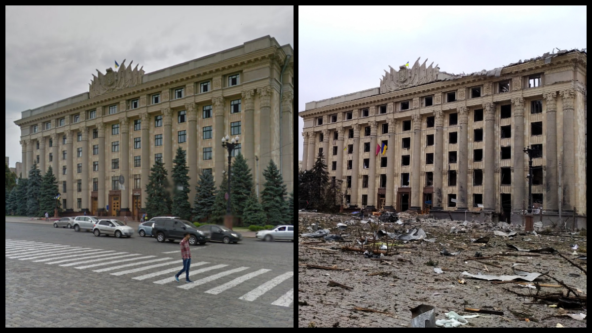
Left: A photo of the Hardy City Hall from 2015, taken by the Google Maps team.
Right: A photo of Sergei Bobok shows us the same municipal building on March 1, 2022, after a Russian bombing. The town hall has suffered severe damage, all its windows have exploded from the explosions. Trees and cars are broken and dusted, their debris scattered on the road.

© Google Street View / Pavel DOROGOY / AP
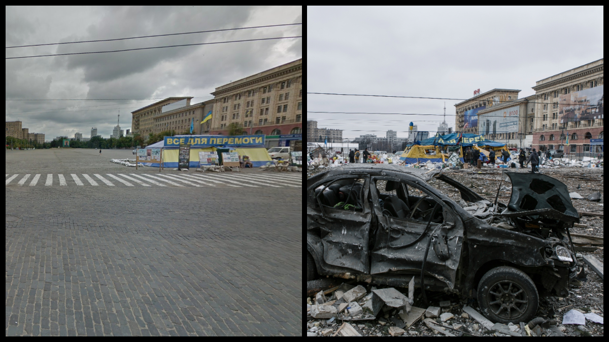
Left: This is an image from Google Maps in the central square of Kharkov in 2015, a real landmark of the city, neglected by the mayor’s office. On this huge esplanade stands a tent, under which Ukrainian volunteers collect food for the poorest. The banner, written in Ukrainian, reads “All About Victory”.
Right: Pavel Dorogoi’s photo testifies to the scars in the central square on March 1, 2022, after a huge explosion caused by a bombardment by Russian troops. In the middle of this place, dear to the people of Kharkov, among the ruins lies a burnt corpse. Partly affected, the food aid camp is still standing.

© Google Street View / Sergey BOBOK / AFP
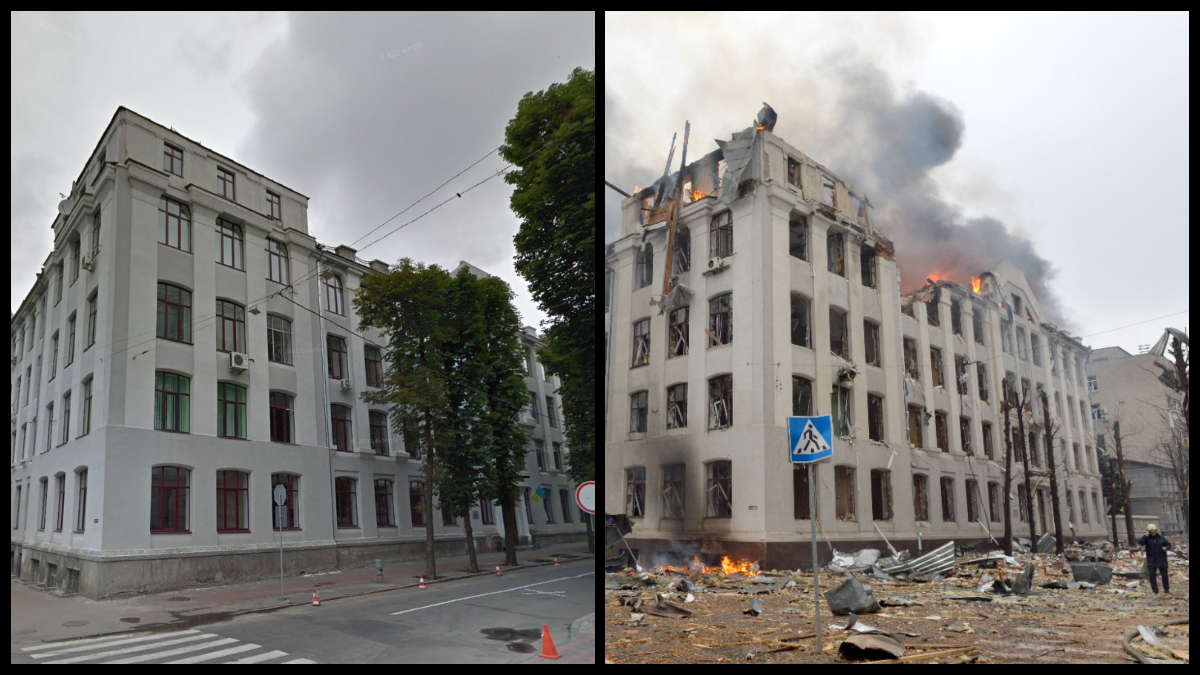
Left: This frame from Google Maps shows us the premises of the Department of Economics at Karazin University in Kharkov.
Right: Sergei Bobok took a photo of the same university building, completely destroyed and still ravaged by fire, on March 2, 2022. This was the day after the intense Russian shelling of this area of downtown Kharkiv, where it is located not far from there. , the headquarters of the Ukrainian security services and police.

© Google Street View / Sergey BOBOK / AFP
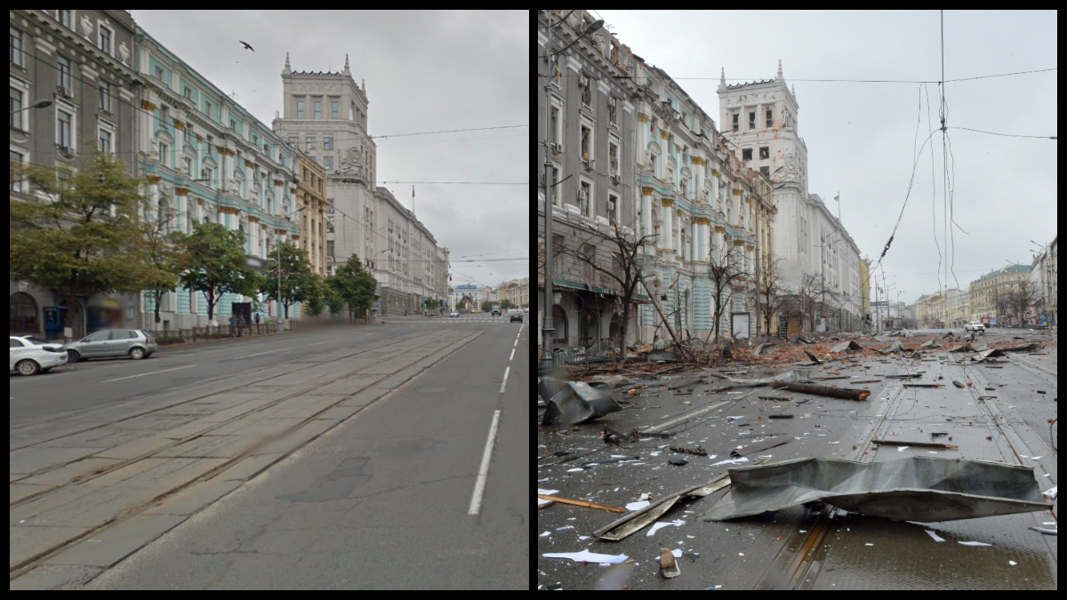
Left: Constitution Square, extended from Sumska Street, was photographed by Google Maps in 2015.
Right: Taken on March 2, 2022, the photo by the AFP photographer offers evidence of the desolation that reigned over this famous city artery after the bombing by Russian aircraft and artillery.
